

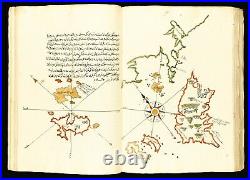
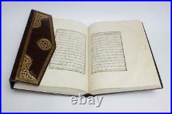

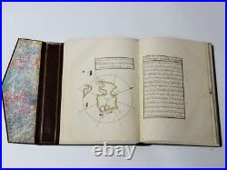
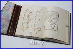
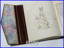
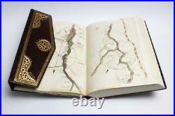

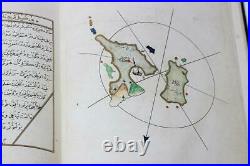


Original Date: 16th Century. HUGE Size: 33 x 23 x 8 cm (13×9 inches). Weight: 5 Kilograms (10 lbs). Publication Type: Facsimile Edition. A very rare and fine illustrated FACSIMILE EDITION manuscript of the Kitab-i Bahriye based on the original version of the great admiral, geographer and cartographer Piri Reis d. The Kitab-i Bahriye (Book of navigation or maritime matters) is an important portolano or book of sailing directions. The charts are based on the tradition of the isolario, introduced by Cristoforo Buondelmonte in 1420 and developed later by Bartolommeo dalli Sonetti and Benedetto Bordone. This work provides important information to naval commanders to enable them to navigate safely around the Mediterranean. Each chapter describes landmarks and the layout of harbours, warns of dangerous rocks, shoals or reefs, and occasionally includes distances or depths. Along with anecdotes and local histories, Piri Reis describes winds and informs the sailor where to find shelter and fresh water, together with military information regarding castles and the fortifications of ports. Manuscript on paper in Ottoman Turkish script in black ink with titles in red ink. 121 numbered hand-coloured manuscript MAPS!! (7 of them are double-page). Bound in Turkish brown morocco with folding flap. Sides with blind-tooled central floral medallion and border. WHAT IS A FACSIMILE EDITION? A facsimile edition is when a publisher recreates, with perfect detail, a particular publication. These editions are usually published in limited quantity and can be a fantastic option for collectors who wish to own memorable and beautiful books but cannot stretch to the original version. The item “1526 Kitab-i Bahriye Islamic Ottoman Maps Facsimile Manuscript not antique books” is in sale since Sunday, December 13, 2020. This item is in the category “Books & Magazines\Antiquarian & Collectible”. The seller is “museumify” and is located in MERKEZ. This item can be shipped worldwide.
- Year Printed: 2014
- Country/Region of Manufacture: Turkey
- Topic: Atlases
- Binding: Leather
- Region: Middle East
- Author: Piri Reis
- Subject: Maps
- Original/Facsimile: Facsimile
- Place of Publication: Istanbul
- Special Attributes: 1st Edition
